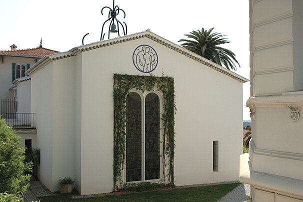
Rosaire Chapel, Vence
Matisse's Final Masterpiece, this chapel, was built in 1949 and designed in its entirety by Henri Matisse.
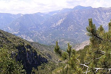
© Alison Shayler
Spectacular scenery & great variety of terrain
This half day scenic hike circles around the north side of Mont Vial, traversing a deep bowl in the Var Valley.
IGN map 3742OT is recommended for this walk

Matisse's Final Masterpiece, this chapel, was built in 1949 and designed in its entirety by Henri Matisse.

The château (more like a townhouse, so don't go looking for turrets) was originally built in the 17th century and was gifted to the town of Vence by Emile Hugues who had been the mayor.

The Gairaut waterfall was constructed in the 19th century alongside a wooden alpine chalet to celebrate the completion of the Vésubie canal.

In 1992, wolves naturally returned to France. It all happened not far from here, in the Mercantour National Park. This park has been created to tell the story of man and the wolf and allow visitors to see wolf packs up close.
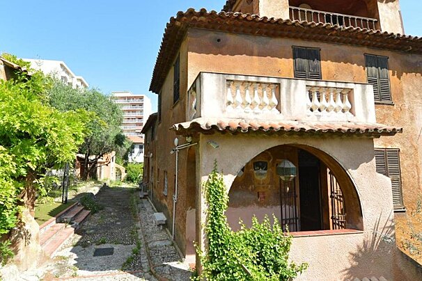
This priory owned by Father Lemerre was converted into a museum at the end of the Second World War and houses his collection of objets d'art from the late Middle Ages and early modern period including French furniture, glass, sculptures and religious paintings.
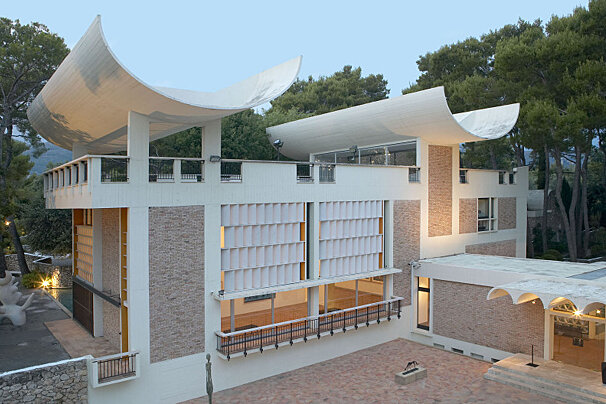
Just outside Saint-Paul de Vence lies one of France's most famous modern and contemporary art museums. Surrounded by pleasant gardens, this is a nice place to spend your afternoon.
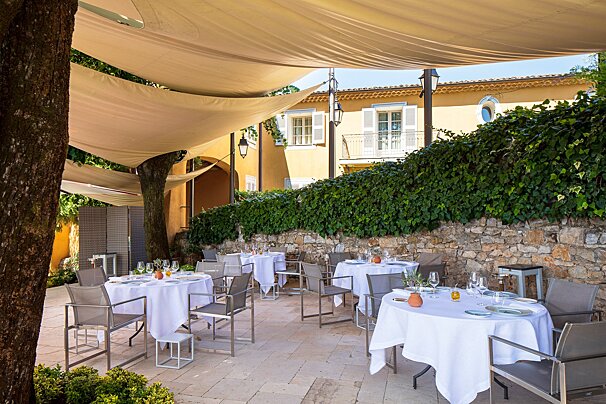
Michelin-starred La Bastide Saint-Antoine offers a refined retreat near Cannes, where chef Jacques Chibois creates inspired Provençal cuisine. Set in a stunning country house with lush gardens and panoramic sea views, it’s the perfect blend of gastronomy, elegance, and tranquillity.

In a Regency-style dining room decorated with magnificent 18th century woodwork, Jean-Denis Rieubland proposes two menus, "Découverte" and "Chantecler".
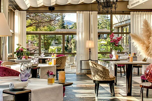
La Table de Pierre offers refined, garden-led cuisine by Chef Emmanuel Lehrer in a romantic setting with views over the estate.
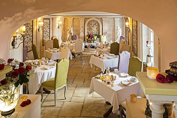
Laurent Paccini is the chef at this Relais & Châteaux hotel and brings the food of different cultures to his excellent Mediterranean restaurant in Saint-Paul de Vence.

Enjoy refined regional cuisine in an iconic setting featuring original works by Picasso, Matisse, Miró and more.

Michelin-starred chef, Didier Anies, recognised as Meilleur Ouvrier de France in 2000, has created a gourmet cuisine at this restaurant; one which is unfussy, full of flavour and low key yet elegant.

Experience the French Riviera your way with 212 yachts, using one of their sample itineraries or with a specialised itinerary created just for you, based on what you like and don't like, as well as their own expertise.

Enjoy a wonderful, peaceful and fume-free journey along the French Riviera on a solar powered motor boat with a professional skipper.

Based in Nice, motorbike and scooter rental so you can explore the South of France.

This company is based in Nice and offers a wide range of road bikes.

Take a trip onboard this luxury yacht along the Riviera to any destination of your choosing.

Enjoy a wonderful, peaceful and fume-free journey along the French Riviera on a solar powered motor boat with a professional skipper.
Starting from the small village of Malaussène you will already have gained 430m in altitude before you even reach the trailhead. Malaussène is on the Train des Pignes line that runs between Nice and Dignes-Les-Bains, it is a short walk of about 1.7km from the train station up to the village or there is free parking if you come by car. The village is not as touristy as some and very quiet, so don’t rely on picking up any supplies here - pack a picnic and whatever else you might need before you set off.
Our adventure starts at the small church perched at the summit of the village, overlooking the tiled rooftops and narrow streets. Climbing up behind the church is a steep footpath that twists away from the village and soon enters a pine forest. After a couple of kilometres you’ll come to a fork in the path where you take the higher route up to the Col du Serse.
On the first part of the trail look out for old stone ruins hidden in the undergrowth; they are the remains of an ancient settlement. As the trail continues to climb you’ll pass through a variety of terrain; the wonderful thing about this hike is that it encompasses just about everything including shady pine forest, colourful wild flowers, rocky scrubland, cacti, olive groves, towering rock faces and cool clear streams. At one point the path scooped round into a horseshoe shape with high rocks all around; the sound of birds bounced and amplified off the stones as if we were in an amphitheatre (or a 1970’s spaghetti western, as my boyfriend rather strangely commented).
The trail climbs quite steeply to just over 1000m, with a bit of a scramble over a few boulders, then begins to loop back round towards Malaussène. Happily this means that most of the route is downhill from now on.
As you circle back round you can look across and clearly see the route that you’ve just taken, etched out on the opposite slope. You’re essentially traversing a big bowl and it’s very satisfying to see the ground that you’ve covered stretching out such a long way behind you!
After a while the path will dip further down and re-enter the forest, where at about 8km you’ll see a signpost for the “gare” - this is a shortcut back to the train station, which might be a handy option if you’re short on time or don’t want to return to the village. However, doing this will miss out one of the highlights of the hike - crossing a 16th century 40m high stone bridge that spans a deep ravine.
From the bridge the village starts to come into view in the distance and it is an easy stroll back to where you started.
Find out all about what is happening in Nice and how to make the most of your time here. The latest news, reviews of fun activities, fabulous beaches, current events and the trendiest restaurants, as well as interviews with leading locals, insider's guides and our top choices for things to do, see and experience in this cosmopolitan city.
See allLatest News & ReviewsYou will not be short of entertainment in this beautiful French Riviera town throughout the year. The most popular public events take place along the Promenade des Anglais, including the Carnival in February, the Bastille celebrations in July and the Nice marathon in November. There are also plenty of live music and cultural festivals.
See allUpcoming Events